Ecofor’s expert geographic information system (GIS) team services a diverse client base within a broad range of sectors, industries, and disciplines.
Our staff are experienced and qualified with a wide range of GIS software and data formats. We are continuously upgrading to remain current to the latest and most innovative techniques in the field.
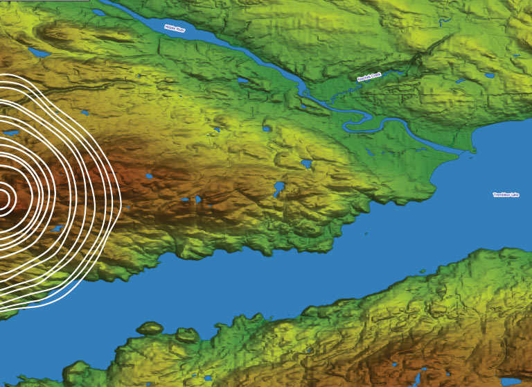
Our team can produce high-quality maps, diagrams, data models, and spatial databases of any variety and any size.
- Database Design and Development
- Spatial Analysis
- Thematic Mapping
- Watershed Analysis
- Terrestrial Ecosystem Mapping (TEM)
- Archaeological Predictive Modelling
- Environmental Mapping
- 3D Modelling and Analysis
- Translations of a Variety of Data Types and Sources
- Data Reprojections and Transformations
- Scanning and Vectorizing
- Forest Management Planning
- Statistical Modelling
Explore Our Other Services
![]()
![]()
![]()
![]()